Data for Clean Air
Uses geospatial interpolation techniques on publicly available air quality information to establish baseline measurements for evaluating the effectiveness of new public transportation infrastructure.
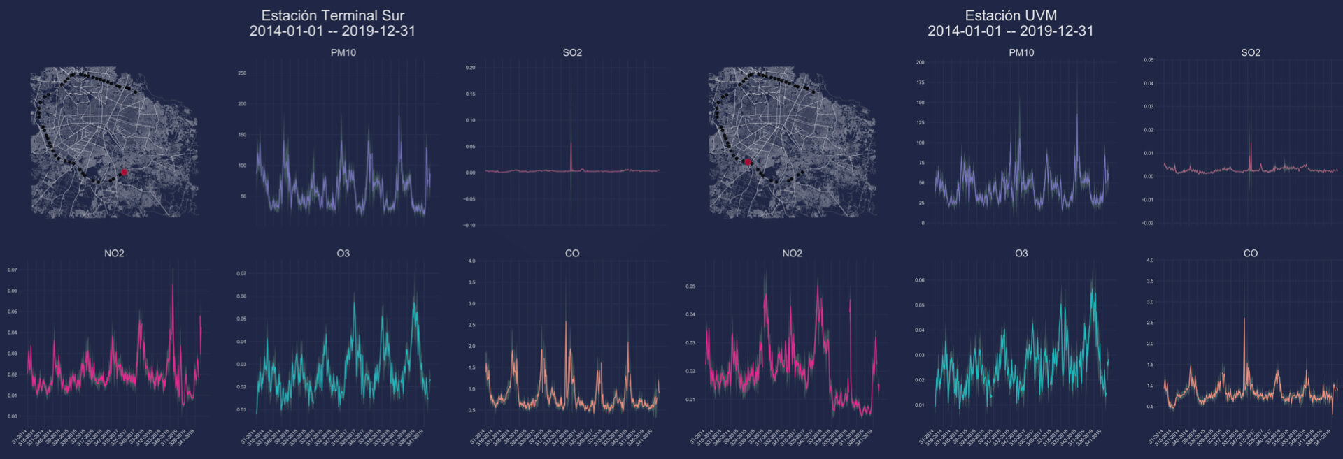
Project Overview
This project applies geospatial interpolation methods to analyze air quality data across urban areas. By establishing baseline air quality measurements, the project enables the evaluation of how new public transportation infrastructure impacts environmental conditions. Along the project, we developed methodologies to work and analyse data from open-source air quality monitoring devices. The project was done in collaboration with Derivé Lab, Google, and Jalisco's Government.
Key Features
Technologies
Developed using Python with geospatial analysis libraries, processing publicly available air quality datasets to provide comprehensive environmental impact assessments.